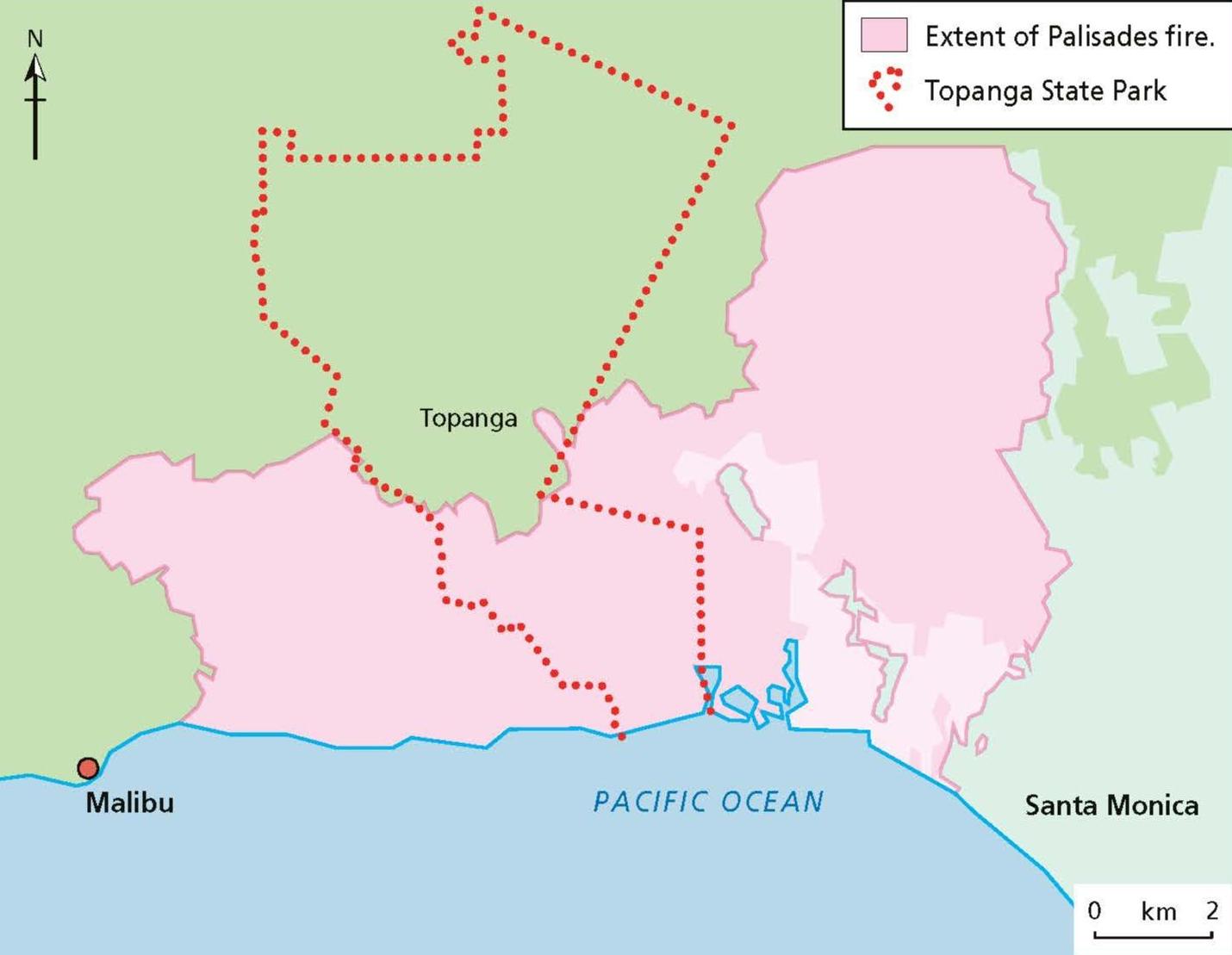
The largest of the Los Angeles fires was the Palisades fire, but three other fires burned at the same time, pushing the local fire services to their limits. The maps here reveal how significant those fires were.
In Figure 1 you can see the extent of the fires that started on open land at the edge of the city but quickly took hold and burned through residential areas. The scale bar of Figure 1 helps us to see how large the fires were. For UK readers, Figure 2 might help us relate to their size even more. This map places the extent of the Palisades fire on top of a map of London. We can see how much of the UK capital would have been affected by a fire this size and how significant the task of rebuilding will be for Los Angeles.
Your organisation does not have access to this article.
Sign up today to give your students the edge they need to achieve their best grades with subject expertise
Subscribe