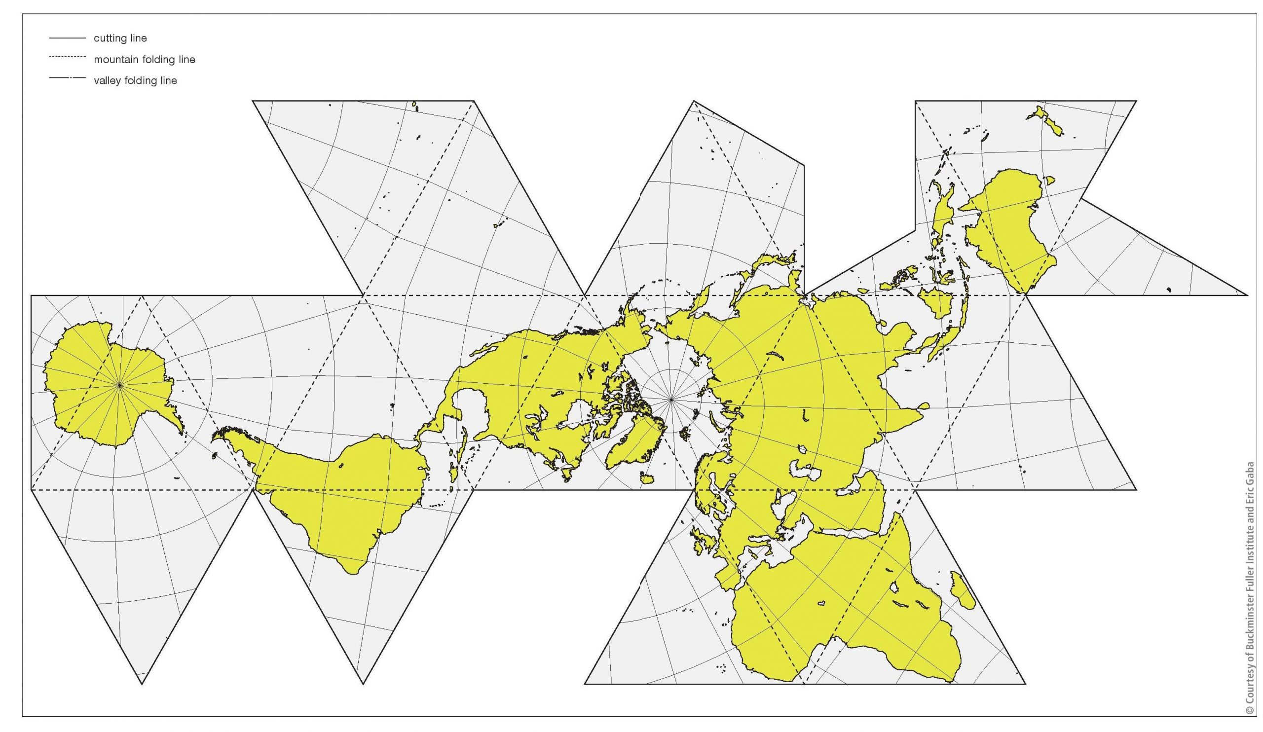
Geography and mapping have long been synonymous. Maps allow us to represent different phenomena that are situated on, just beneath, or just above the face of the Earth at scales of our choosing. A 2D global map of the continents and oceans is perhaps the best known of all the maps ever made. This map can be created using various projections, which are transformations of a curved surface (the Earth, in this case) to a plane. Normally, world maps display the Americas to the left and Asia and Oceania to the right, with the poles top and bottom and lots of ocean between the various continents. We see these maps all the time on television news reports and daily weather forecasts.
This is why the so-called Dymaxion world map shown here is so striking. It was designed by American inventor and maverick Richard Buckminster Fuller (1895–1983). Fuller coined the term ‘dymaxion’ to mean any design that gives maximum advantage with greatest efficiency or least effort. He wanted a world map that did not distort the relative size or shape of the continents, unlike the famous Mercator Projection which ‘shrinks’ Australia and enlarges Greenland. His Dymaxion map was first published in American in 1943 in Time magazine.
Your organisation does not have access to this article.
Sign up today to give your students the edge they need to achieve their best grades with subject expertise
Subscribe